
We locate underground utilities
so you can build with confidence.

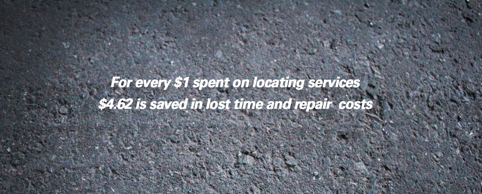
For every $1 spent on
locating services $4.62 is saved
in lost time and repair costs

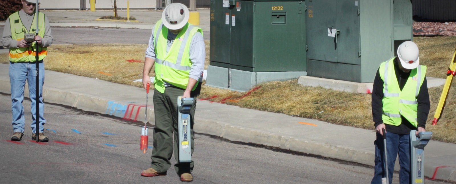
UCS has been providing high accuracy
utility designating of all public and
private utility infrastructures of
utility throughout Colorado and
surrounding states for over a decade.

What locate do I need?
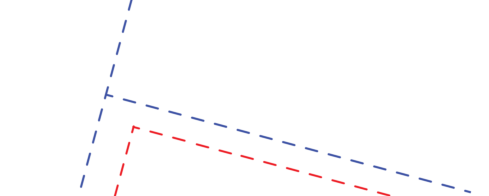
Subsurface Utility Engineering (SUE) services enable project designers to manage risks associated with surprise encounters of buried utilities. These services have been proven to reduce construction costs related to the risks associated with inaccurate or incomplete utility information. The process is defined by a publication of the American Society of Civil Engineers entitled “Standard Guideline for the Collection and Depiction of Existing Subsurface Utility Data” (ASCE CI 38-02). This standard establishes four levels of quality:
Each of the four quality levels is described as follows:
- Quality Level D. QL-D is the most basic level of information for utility locations. It comes solely from existing utility records or verbal recollections, both typically unreliable sources. It may provide an overall "feel" for the congestion of utilities, but is often highly limited in terms of comprehensiveness and accuracy. QL-D is useful primarily for project planning and route selection activities.
- Quality Level C. QL-C is probably the most commonly used level of information. It involves surveying visible utility facilities (e.g., manholes, valve boxes, etc.) and correlating this information with existing utility records (QL-D information). When using this information, it is not unusual to find that many underground utilities have been either omitted or erroneously plotted. Its usefulness, therefore, is primarily on rural projects where utilities are not prevalent, or are not too expensive to repair or relocate.
- Quality Level B. QL-B involves the application of appropriate surface geophysical methods to determine the existence and horizontal position of virtually all utilities within the project limits. This activity is called "designating". The information obtained in this manner is surveyed to project control. It addresses problems caused by inaccurate utility records, abandoned or unrecorded facilities, and lost references. The proper selection and application of surface geophysical techniques for achieving QL-B data is critical. Information provided by QL-B can enable the accomplishment of preliminary engineering goals. Decisions regarding location of storm drainage systems, footers, foundations and other design features can be made to successfully avoid conflicts with existing utilities. Slight adjustments in design can produce substantial cost savings by eliminating utility relocations.
Quality Level A. QL-A, also known as "locating", is the highest level of accuracy presently available and involves the full use of the subsurface utility engineering services. It provides information for the precise plan and profile mapping of underground utilities through the nondestructive exposure of underground utilities, and also provides the type, size, condition, material and other characteristics of underground features.
Description:
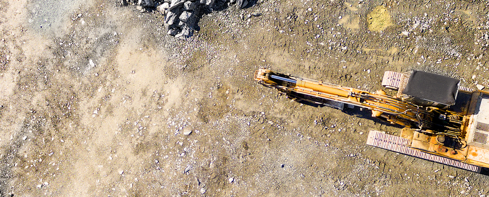
Hydro-Excavation is a non-destructive process which combines pressurized water and a high flow of moving air to excavate soils and exposed the utility. The soil and water slurry are conveyed via a hose to a truck-mounted debris tank. This process allows for quick, clean and precise excavation which requires less backfill, less restoration, and less environmental impact than conventional digging methods. After the utility is exposed the depth, material, dimension and condition of the object is documented.
Typical Applications:
Virtually any excavation job that involves existing utilities:
- Underground utility location verification
- Manhole and catch basin cleaning
- Debris removal
Considerations:
- No risk to existing utilities
- More productive than open pit/backfill methods
- Clean and self-contained
- Compact applications
Limitations:
Vacuum cannot move large rocks and boulders greater than 12” in diameter.
By law, you must locate utilities before beginning any sort of excavation project. Before doing any digging, everybody needs to call their respective 811 State One-Call. However, this free service only covers underground public utilities from the street to service meter and does not cover private utilities. Privately- and customer-owned utilities account for almost 65% of all buried utilities in the United States. A private utility could be a gas line, electric line, water line, communication line, etc. We have a vast amount of experience in locating these private utilities to keep them from being damaged and reduce the potential for injury. UCS’s services do not replace the One Call system but the public system and our services should supplement each other to provide a more thorough utility investigation.
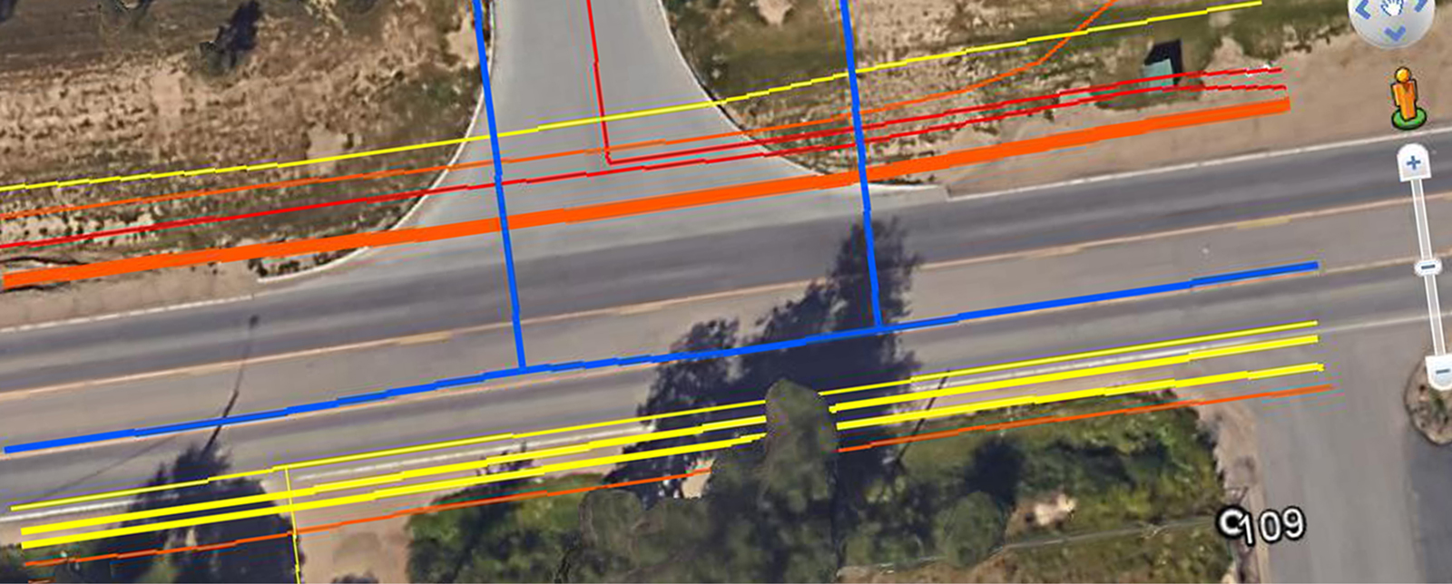
GPS Mapping can be used for many reasons including underground utility mapping and inspection, water network modeling, and as-built mapping of lines and cable installations.
For utility companies, municipalities, environmental management agencies, and many other organizations, timely accurate information is paramount to quality decision making.
Underground Consulting Solutions (UCS) uses the most advanced electro-magnetic radio frequency induction and GPS tools available.
Our GPS equipment can achieve accuracies of up to one centimeter in an open sky environment using VRS.
Our EMRFI equipment communicates with our mapping equipment through Bluetooth. With this option we are able to receive additional information from the unit such as milliamp gains, Depths, Peak signal strengths and what frequency was used to locate the utility. During the mapping process we take a shot on the peak of the signal that the EMRFI equipment provides, which can be more accurate than shooting the paint marks on the ground. With these technologies combined UCS can locate all conductive utilities without confusion and map a site without putting a single mark on the ground.
Experience
Underground Consulting Solutions has been a leader in the locating industry in Denver for over 15 years.
We have over 100 years of collective experience and use the most advanced and cutting edge equipment in the industry.
We are also a certified DBE(Disadvantaged Business Enterprise), EBE(Emergent Business Enterprise), SBE(Small Business Enterprise).
We also hold a Woman Owned Business certification through WBENC.